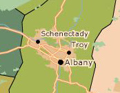
Fun with GIS & National Geographic online maps
 For those of you who like a good map, here's a fun tool:
Using GIS data from ESRI (a leader in the GIS software & data field - pssstt... we bought some way cool data from them that you'll be hearing more about soon...) National Geographic's MapMachine offers good looking satellite views, physical maps and road maps.
But it also provides theme maps on a range of topics, including weather, population density, natural disasters, and nature & conservation. While many of these topics are probably more applicable to school projects, others (perhaps congressional district maps or land use maps?) just might be useful at work.
Whatever your motives, its pretty cool.
Comments